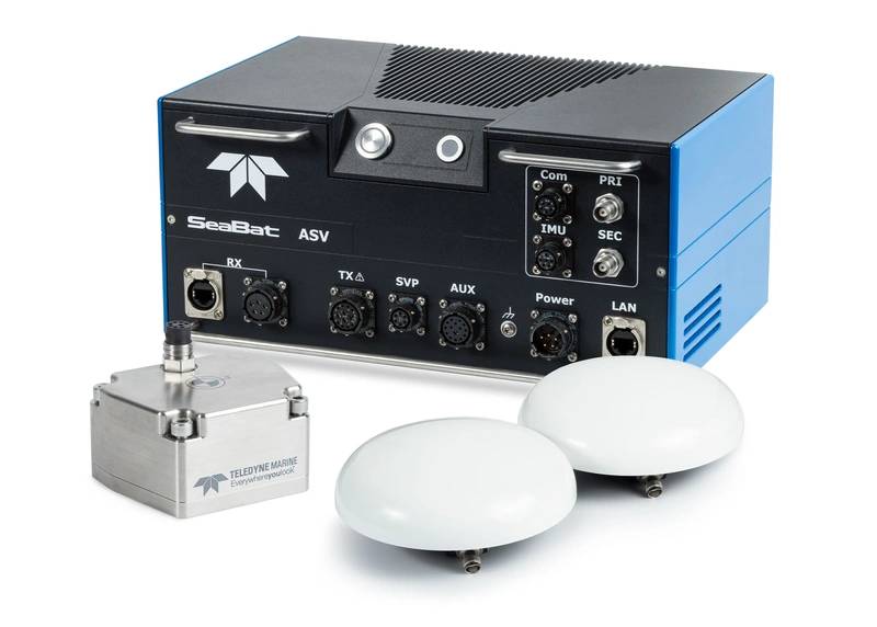
Introducing the Teledyne Marine Intrepid: The Future of GNSS/Inertial Navigation
In the continually evolving world of marine technology, precision and efficiency are paramount. Enter the Intrepid, a groundbreaking GNSS/Inertial Navigation System launched by Teledyne Marine. This innovative system is set to reshape navigation in marine surveying, combining sophisticated technology with intuitive usability. Let’s delve into what makes the Intrepid a game changer in the field.
Seamless Integration with SeaBat Technology
At the core of the Intrepid is its integration with the SeaBat T20-ASV processor, a name synonymous with cutting-edge sonar solutions. The Intrepid system features a compact Inertial Measurement Unit (IMU) along with two GNSS antennas, ensuring that users can benefit from reliable and precise positioning even in challenging marine environments. This integration not only enhances navigational accuracy but also streamlines the collaborative use of software and hardware.
Effortless Data Management
One of the Intrepid’s standout features is its ability to eliminate manual interfacing between sensors. No longer will operators need to juggle various systems to gather data. The Intrepid automatically streams data to third-party software, significantly minimizing the risk of human error while also reducing downtime. This automation is particularly beneficial in marine surveying, where time efficiency can be critical.
Centralized System for Simplified Updates
Keeping software and firmware updated can often be a cumbersome task. However, the Intrepid takes a different approach. It offers a centralized system that simplifies both firmware and software updates. This means that users can effortlessly access the latest features and enhancements without the need for complicated procedures. Such a streamlined approach ensures that users can continue to operate at peak performance with the latest technological advancements at their fingertips.
Enhanced User Experience
Designed with the end user in mind, the Intrepid GNSS/Inertial Navigation System boasts an intuitive interface that makes it easy to configure and monitor. This ease of use is a game changer, particularly for entry-level operators who might find more complex systems daunting. With the Intrepid, even those new to marine surveying can swiftly set up the system, enabling them to receive immediate feedback on navigational status.
Immediate Feedback for Operational Efficiency
The ability to provide immediate feedback is another aspect that distinguishes the Intrepid in the marketplace. In a field where every second counts, having real-time insights into navigational status can significantly enhance operational efficiency. Operators can make informed decisions on the fly, ensuring that their surveys are both accurate and timely.
A Unified Software Experience
Teledyne Marine’s intent to simplify user interactions is highlighted by the integration of the SeaBat sonar software and the Intrepid software into a single program. As Pim Kuus, Senior Hydrographer and Product Manager for Instruments & Imaging at Teledyne Marine, states, this innovation has made the system “simple and easy to use for the operators.” Such a unified approach allows users to engage with the system seamlessly, without the need to switch back and forth between different applications.
Conclusion
The Teledyne Marine Intrepid GNSS/Inertial Navigation System is not just another tool in the marine surveying toolbox; it represents a significant leap forward in technology. With features designed to enhance efficiency, simplify operations, and provide real-time data, the Intrepid is poised to be an indispensable asset for marine professionals across the globe. Whether you’re a seasoned expert or just starting in the field, the Intrepid promises a transformative experience in marine navigation.
